Appetite for Survival
From wet markets to dai pai dongs: tracing hunger and sustenance
Hong Kong’s identity centers on its culinary pluralism: from mid-century dai pai dongs to high-end dining rooms. This landscape evolved from a frontier of survival shaped by the logistics of moving calories across markets, processing hubs, and empires. A network of street names preserves this century‑long record of provisioning, regulation, and improvisation. This three‑part series traces Hong Kong’s relationship with food and drinks through its map.
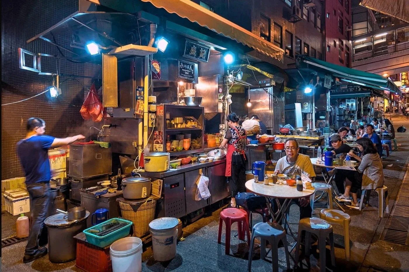
Tables wobble, flavours don’t (source: Honey Combers)
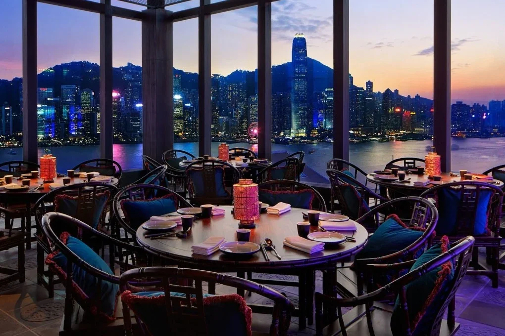
The view now costs extra (source: SCMP)
A Raw Deal
Net Profits
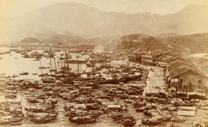
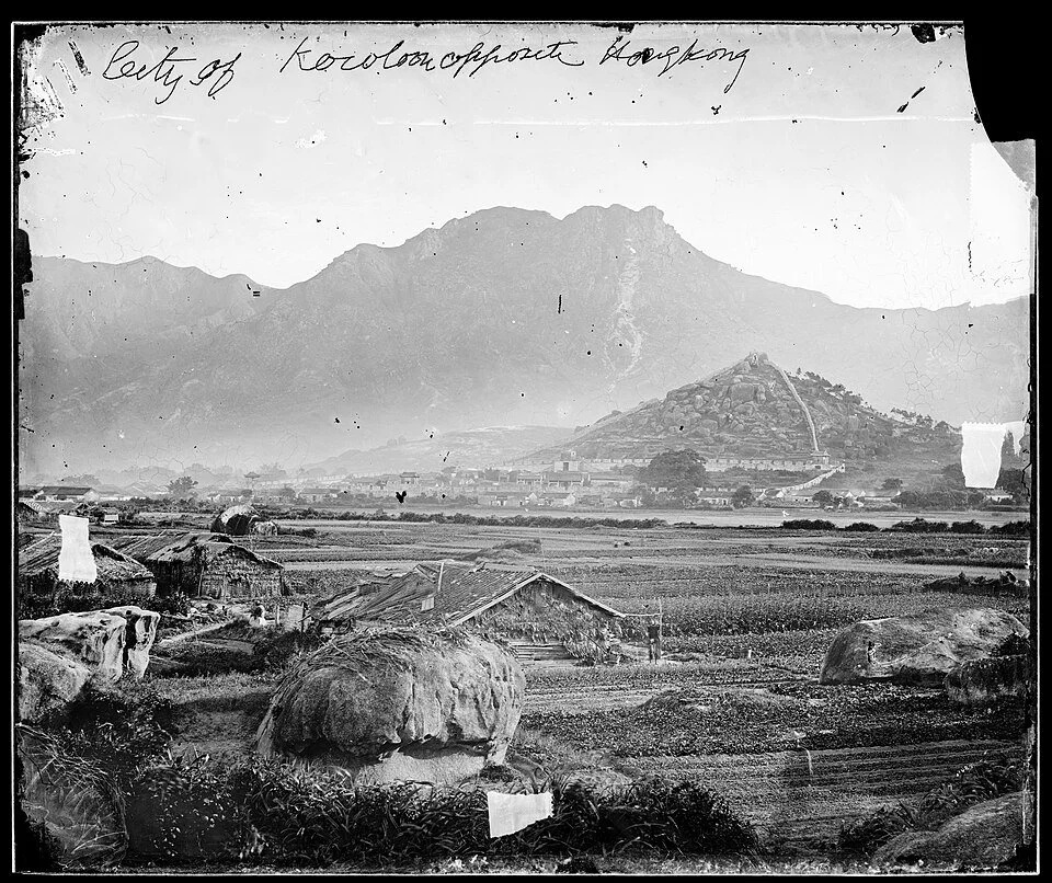
Shore of Yau Ma Tei in 1880 (source: wiki)
Hong Kong’s first food economy began at sea, mapped by the boat‑dwelling Tanka and Hoklo communities. On a regional level, coastal markers like Tsing Yi 青衣 (“Black Tuskfish”), Lung Ha Wan 龍蝦灣 (“Lobster Bay”), and Yau Yue Wan 魷魚灣 (“Squid Bay”) mapped marine biodiversity straight onto the shoreline. Locally, when Aberdeen’s Shek Pai Wan was urbanised in the late 1960s, planners mirrored this heritage with a cluster of “Yue 漁” lanes such as Yue Fung Street 漁豐街 ("Abundant Fishing Street"), Yue Lei Street 漁利街 ("Profitable Fishing Street"), and Yue Wok Street 漁獲街 ("Fish Catch Street").
The map also preserves the logistics of extraction. Yau Ma Tei 油麻地 was once a coastal village defined by net maintenance. In the pre-nylon era, deep-sea nets were woven from heavy hemp twine (Ma 麻) and waterproofed with tung oil (Yau 油) to prevent rot. The trade of drying, mending, and sealing these nets stamped the district’s identity long after the water retreated.
Sok Kwu Wan 索罟灣 on Lamma Island offers an equally refers archive: Sok 索 denotes heavy mooring ropes, and Kwu 罟 referring to the nets themselves. Further along the coast, Mong Yue Kok (望魚角, “Watch Fish Corner”) and Cha Yue Pai (炸魚排, “Bomb Fish Raft”) memorialise cliffside lookouts and blast fishing, a highly efficient, if ecologically ruinous, extraction method now outlawed.
Markets of Emptiness

Yuen Long Old Market, founded in 1669, once served as the district’s primary trading centre (source: Hulu HK)
Inland Hong Kong developed its own commercial geography as agricultural plains required nodes to distribute their yields. The Chinese character hui (墟), conceptually interchangeable with emptiness (虛), carried a distinct temporal meaning for these gathering places. As the Qing-era text Guangdong Xinyu observed:
"In Guangdong, a rural market is called hui. When people gather, it is full; when they disperse, it is empty. Fullness is rare, emptiness is common—hence the name."
「粵謂野市曰虛。市之所在,有人則滿,無人則虛。滿時少,虛時多,故曰虛也,虛即廛也。」
In the fertile plains of Yuen Long, Sheung Shui, Fanling, and Tai Po, indigenous clans established these nodes to trade surpluses. By 1819, hubs like Yuen Long Hui (圓蓢墟) and Shek Wu Hui (石湖墟) were vital engines of exchange.
The ghost of this rhythm survives in Yuen Long Old Market. Founded by the Tang clan in the Ming dynasty, it clustered around Cheong Shing Street 長盛街 (“Long Prosperity Street”), Lei Yik Street 利益街 (“Profits Street”), and Wine Street 酒街. By the 19th century, over a hundred inns, wine houses, and grain firms crowded this grid. Mid‑century urbanisation erased the physical stalls, but the commercial optimism of its street names endures.
Worth Their Salt
Preserving hauls in a punishing subtropical climate demanded Hong Kong’s oldest state‑controlled enterprise: salt. For over two millennia, the salt trade was heavily taxed and regulated across Imperial China, where the court managed the coastline through government pans, treating the condiment as fiscal currency.

Salt worker in Tai O (source: Industrial History HK)
The imperial presence lingers in the map. Kwun Tong (觀塘, originally 官塘 “Official Pond”) operated during the Northern Song dynasty as Kwun Fu Cheung (官富場, “Official Government Wealth Field”), one of the earliest recorded toponyms on Kowloon Bay. Other traces remain scattered along the shoreline, from Yim Tin Tsai 鹽田仔 (“Small Salt Pan”) in Tai Po to Yim Liu Ha 鹽寮下 (“Below the Salt Depot”) in Sha Tau Kok.
However, these were not peaceful agrarian outposts. As salt was effectively liquid tender, the high margins of the black market bred fierce resistance against dynastic authority. In 1197, under the Southern Song dynasty, that tension erupted in Tai O. When Lantau’s independent salt-makers defied the imperial monopoly, clashes with enforcers ended in the massacre of more than 300 salt workers. The colonial government extended this tradition of state control in 1844 by introducing its own short-lived salt tax, cementing the commodity's link to revenue and regulation.
Scents and Sensibility

Dried seafood shop in Sai Ying Pun (source: TimeOut HK)
Salt gave Cantonese cuisine one of its defining flavors: ham yu (鹹魚, salted fish). Once the fuel of the working poor, captured in the idiom “eat salted fish, endure the thirst” (食得鹹魚抵得渴), its savory depth crossed class lines to elevate both rice bowls and banquet dishes.
Fishermen traded their catch along the Sai Ying Pun beachfront. By 1858, the district claimed nearly 60% of the colony’s fish stalls, an informal shoreline trade that institutionalised into a permanent marketplace officially christened Ham Yu Street 咸魚街 (“Salted Fish Street”). Late-1880s reclamation landlocked the trade. By 1894, a colonial administration grappling with the bubonic plague declared these brine-soaked workshops a biohazard and demolished the original alley.
When the site was redeveloped, authorities renamed the paths Mui Fong Street 梅芳街 (“Plum Fragrance”) and Kwai Heung 桂香街 (“Osmanthus Fragrance”). This linguistic pivot substituted floral names to mask the unappetising reality of the mui heung (霉香, "mold-fragrant") fish cure, cloaking an industrial heritage in poetry. A downscaled Ham Yu Street 咸魚街 still survives nearby, anchoring the sensory reality of the trade in Sai Ying Pun.
The Colonial Shift
Floating Assets
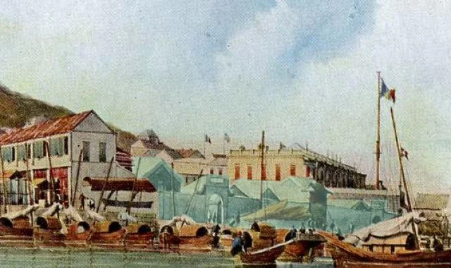
Hong Kong’s early food supply was shaped by the Canton System, under which Western merchants obtained provisions through officially appointed Chinese compradors. In times of conflict, Guangdong officials suspended these intermediaries to halt supplies. In 1839, Commissioner Lin Zexu imposed a blockade that cut off provisions to Macau, pushing British merchants and troops back onto their ships.
Despite the Qing government’s threat of execution for "traitors," local fishermen and boatmen drew on maritime trading networks to supply the British fleet. Selling directly from bumboats and sampans, they turned anchorages at Victoria Harbour, Tung Kwu (Lung Kwu Chau 龍鼓洲), and Kap Shui Mun (汲水門) into a vast “floating marketplace” of up to 2,000 boats, described by contemporary Western newspapers as a chaotic “floating Wapping.”
Traders eventually erected temporary matsheds on nearby beaches, forming the early templates for landward bazaars. Tsim Sha Tsui emerged as a key node funnelling vegetables from the mainland, while operators bartered cattle, poultry, and fresh fish, often trading livestock for Bengal opium. The missionary Karl Gützlaff recorded hawkers doing brisk business in livestock. His name survives in Gützlaff Street (吉士笠街) in Central: a narrow lane beside Graham Street Market, where the rhythms of open-air provisioning still echo.
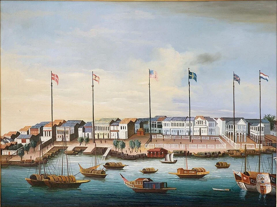
The Port of Canton in 1830s (source: wiki)

Graham Street market, one of the last standing open air markets in Hong Kong (source: HK Tourism Board)
The Birth of the ‘Big License’
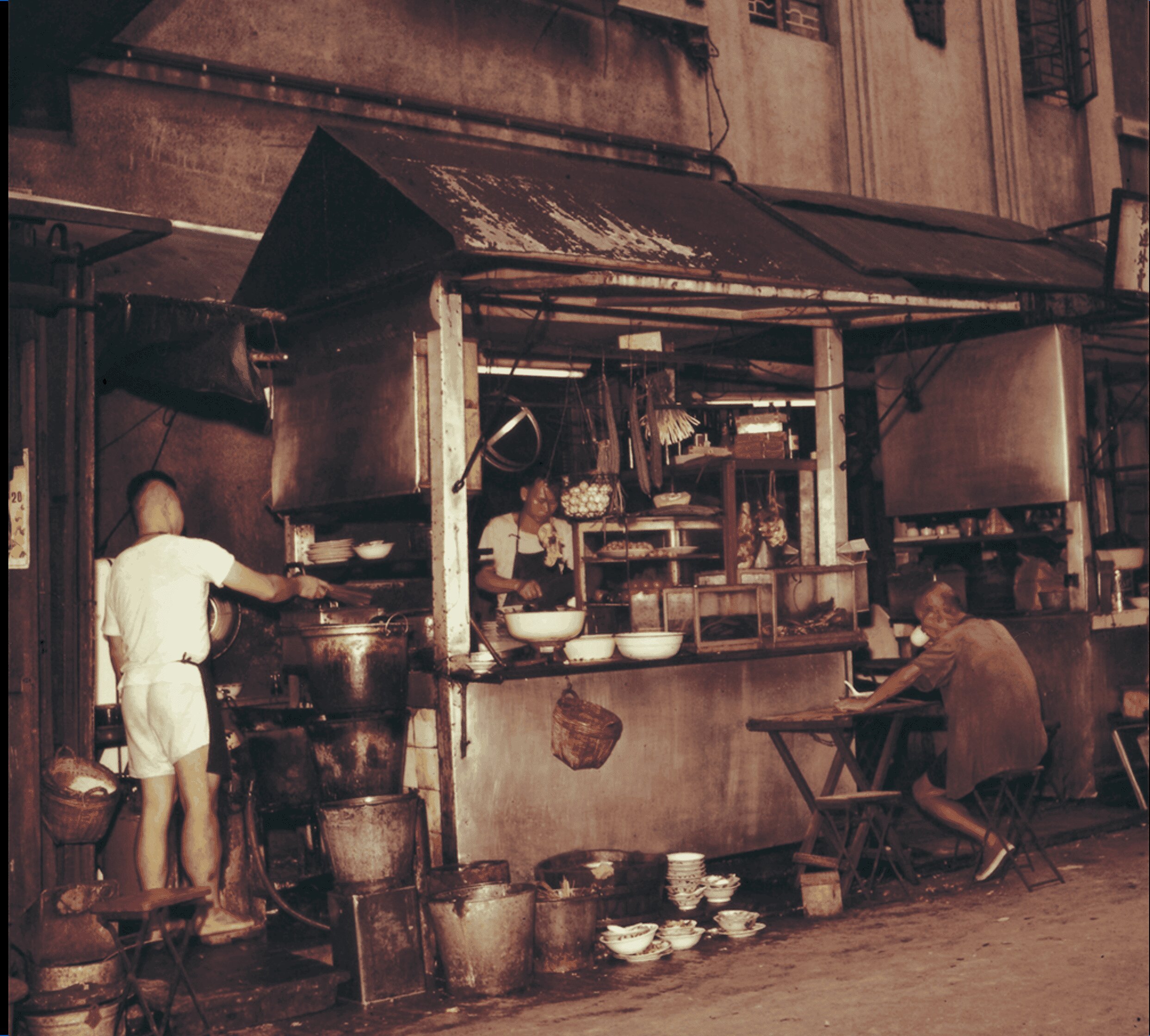
A dai pai dong, or “big licence stall”, in the early 1960s (source: HK Memory)
With Britain’s official 1841 occupation of Hong Kong, the food supply came ashore. Traders poured in from the Pearl River Delta, and within months, some 600 hawkers crowded Queen’s Road. To manage this congestion, the colonial government introduced a regulatory framework in 1847 that birthed a dining legend: the Dai Pai Dong (大排檔).
The dining style blossomed fully post-WWII. Facing wartime devastation and a massive refugee influx from mainland China, the government issued special public cooked-food licenses to boost employment. To prevent unregulated street vending, the government required these fixed stalls to prominently display their permits. Unlike ordinary roadside hawkers, these vendors received a large sheet of paper detailing licensee and stall information. Framed and hung at their designated street coordinates, this "big license" gave the street kitchens their legendary name.
These stalls became vital economic lifelines for penniless immigrants. Streets turned into vibrant open-air kitchens shaded by green canvases. However, by 1972, the government stopped issuing new licenses to eliminate street obstructions, gradually pushing vendors into indoor cooked food markets
Zoning the Chaos
Determined to impose structural order, the colonial administration partitioned the Chinese population into designated Bazaars in Sheung Wan. The government countered the resulting density of hawkers and open-air butchering with a twin strategy: street hawking bans and the construction of regulated public markets.
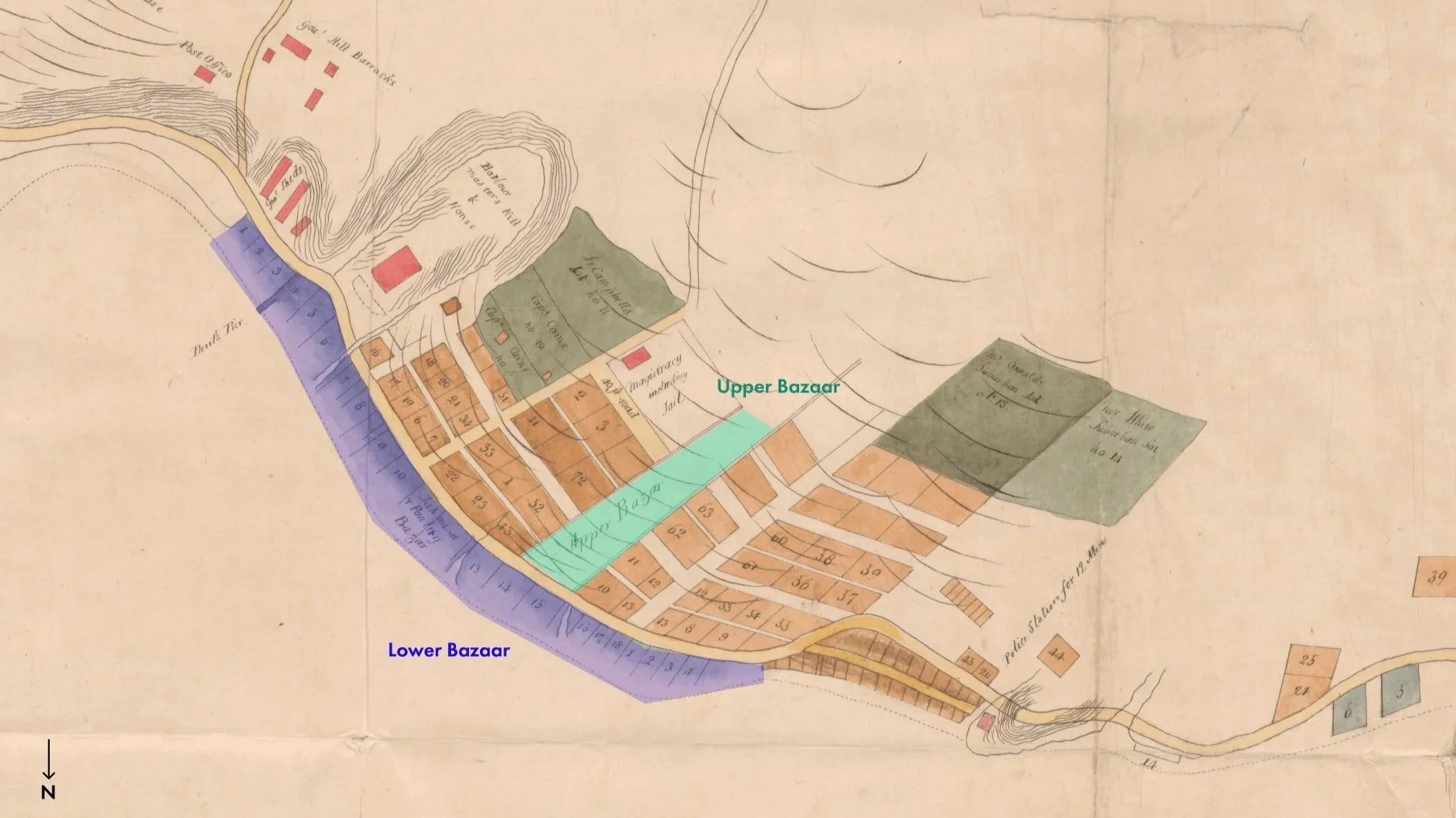
Check out the 1842 Plan of Hong Kong on HK Maps to see where this is in present day (source: UK National Archive)
At the center of this system stood Central Market, opened in 1842 on Marine Lot No. 16. Positioned precisely at the hinge between the Upper and Lower Bazaars, its walled rectangle faced the Praya to intercept both land traffic from Queen’s Road and boat traffic from the harbour. This was the colony’s first purpose‑built attempt to pull the provisioning trade into a regulated, taxable space. Eastern Market followed in 1844 near present‑day Arsenal Street, and Western Market in 1858, confining the fish, vegetable, and meat trades within clean colonial walls.
Map showing Central Market in 1845 (source: UK National Archive via HK Maps)
Oil painting of the walled-Central Market next to P&O headquarters around 1851 (source: Gwulo)
Oligarchs of Flesh
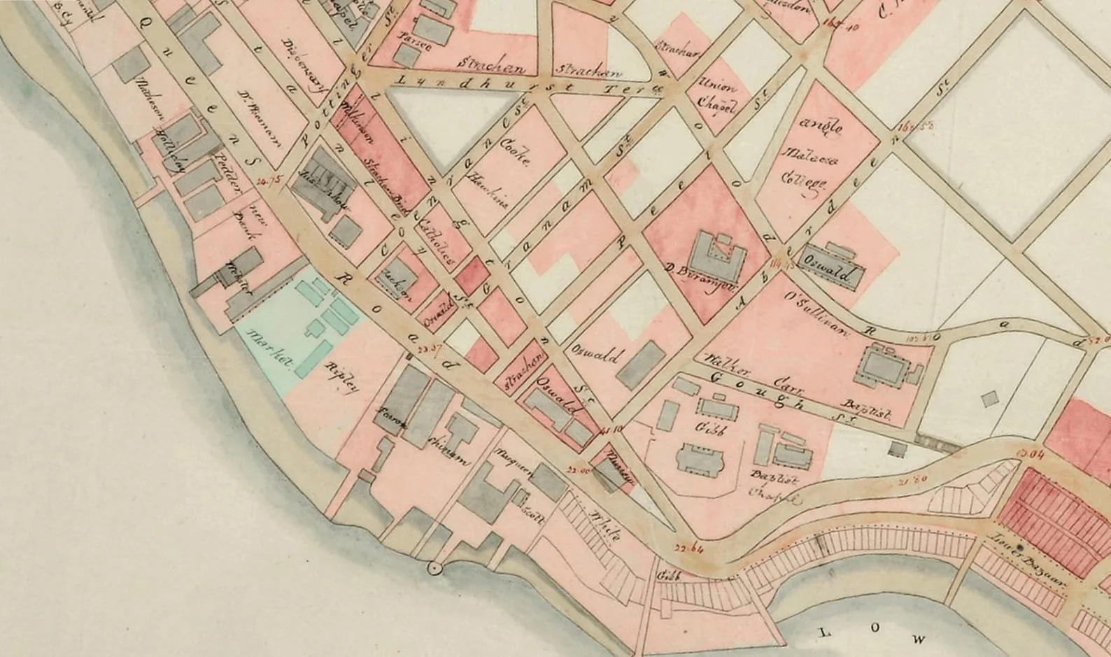
In 1844, the administration cleared the ad‑hoc Middle Bazaar and forced the Chinese population uphill into Taipingshan. To operationalize municipal markets without public funds, Governor John Davis introduced the “market farming” system, auctioning exclusive operating and taxing rights to the highest bidder. This privatisation policy created a new class of wealthy Chinese food oligarchs.
Loo Aqui 盧亞貴, a Tanka man who parlayed wartime British provisioning into land rewards, secured a foothold at the Lower Bazaar. Kwai Wah Lane 貴華里 in Sheung Wan still bears his alias. From this base, he built a property empire funded by gambling dens and brothels, co‑founding Man Mo Temple before speculative losses bankrupted him by 1855.
Securing live cattle from the mainland was a high‑stakes trade dominated until the 1870s by Kwok Acheong 郭甘章/郭亞祥/郭松, nicknamedNgau Lan Atsung (牛欄阿松, “Cattle Market Atsung”). Like Loo Aqui, Kwok was a Tanka man who transitioned from wartime British provisioning to a massive shipping empire, becoming the single largest individual ratepayer in the colony. His corporate legacy remains on the map via Fat Hing Street 發興街, named after his company, while A Chung Lane 郭松街 has since vanished.

1901 plan of Victoria showing the three streets named after Loo Aqui and Kwok Acheong (source: HK Maps)
Sanitising the Grid
Living Stock
While tycoons like Kwok Acheong amassed fortunes commanding the cattle pipeline from the safety of shipping offices, the physical reality of that livestock on land triggered an immediate urban crisis. As meat and dairy could not be stored, livestock had to remain alive until the very moment of slaughter. Traders dragged cattle and pigs directly into ground-floor tenements, turning them into urban barns where livestock stood tethered in darkness beneath the cramped cubicles of labourers.
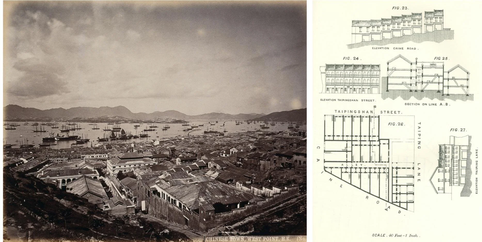
A view of the Chinese tenements in the city of Victoria, 1870s and drawings showing typical configurations of Chinese tenements in Taipinghshan, 1882 (source: academia.edu)
This human-animal proximity created the perfect vector for the 1894 bubonic plague, which devastated Taipingshan. The crisis was etched into Pound Lane 磅巷, named for the Government Pound that impounded stray livestock. In the aftermath, authorities demolished the slums, rewrote zoning laws, and exiled livestock trading to Kennedy Town, establishing centralised slaughterhouses at Smithfield 士美菲路 (named after London’s famous meat market).
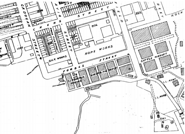
1889 map (source: Industrial History HK)
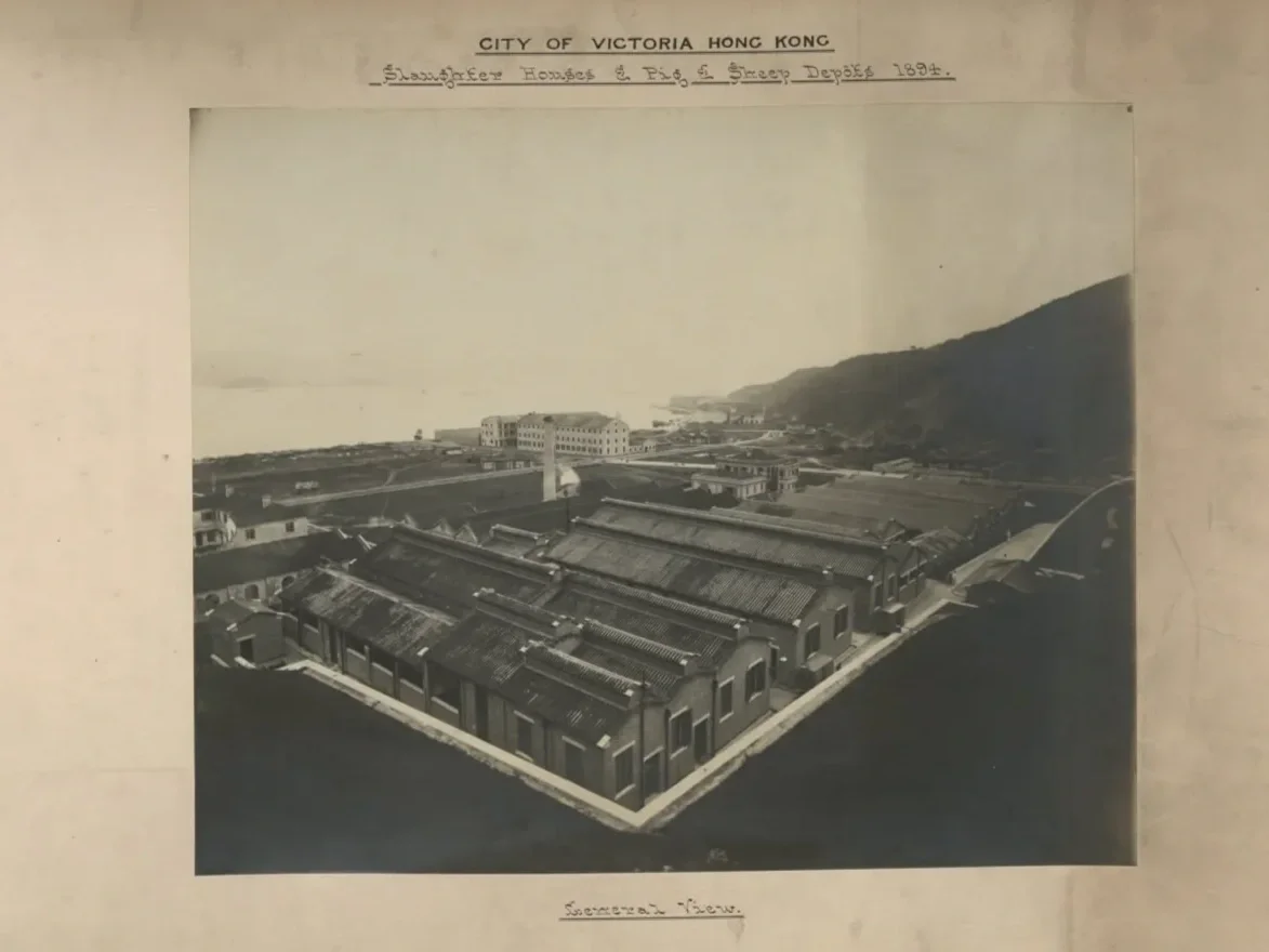
1894 photo showing slaughterhouses and pig and cattle depots in Smithfield, Kennedy Town (source: Industrial History HK)
Street Cleaning
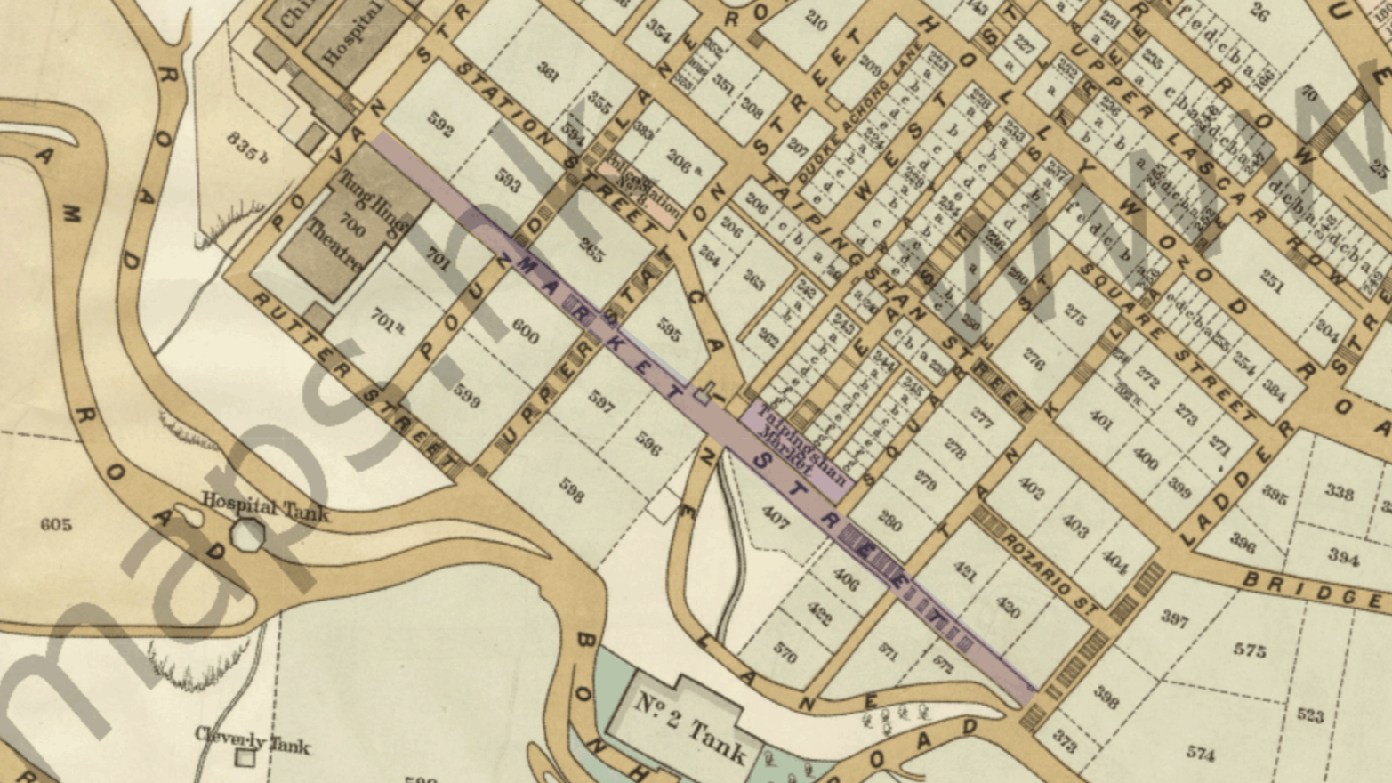
This desire to scrub the city of its messy history extended to the map. As public markets multiplied, adjoining lanes were pragmatically christened "Market Street" (街市街). By the early 20th century, a dozen identical Market Streets created administrative headaches for postal deliveries and police patrols, prompting a systematic cartographic purge.
In Sheung Wan, the original Market Street was the epicenter of the 1894 plague. After the government demolished the tenements, the street was reborn in 1909 as Po Hing Fong 普慶坊 (“Terrace of Universal Celebration”), replacing mass mortality with forced optimism. Across the harbour, Hung Hom’s Market Street was renamed Wuhu Street 蕪湖街, replacing its market identity with a mainland Chinese city.
Today, only the Market Streets of Yau Ma Tei and Tsuen Wan survive as linguistic fossils. Western Market fronts New Market Street 新街市街, a name introduced when the government extended the market northward onto newly reclaimed land over a century ago, freezing the exact moment the colonial footprint shifted.
Po Hing Fong: where a plague street was rebranded as a celebration; plan of the City of Victoria circa 1889 (source: HK Maps)

A dockyard market recast as a mainland city; plan of Kowloon Peninsular circa 1908 (source: HK Maps)
Plotting Growth
Monetise the Marshland
Kowloon looking towards Kowloon City in 1870 (source: wiki)
Before it became one of the densest urban districts on Earth, modern Mong Kok was a coastal marshland known as Mang Kok (芒角, "Corner of Fern-Gorse"). Under British administration, Chinese farmers cleared the brushland and engineered the swamps into productive market gardens to feed a growing population.
When the government later paved over the area, this agricultural layout dictated the urban grid. The rectangular geometry of the old water plots provided a ready-made template for developers, permanently locking the footprint of Mong Kok’s modern streets to the dimensions of vegetable fields.
This history is preserved in the street names. Sai Yeung Choi Street (西洋菜街) marks where flooded fields grew watercress, a European herb introduced through Macau that became a staple of Cantonese soups, while Tung Choi Street (通菜街) was named after adjacent fields of water spinach. As these crops required intensive irrigation, the pooling water triggered public health complaints about mosquitoes. The colonial government eventually evicted the growers to rural districts, replacing the marshlands with concrete high-rises.
Rooted in Myth

Hoi Shum Island in the 1840s, now reclaimed (source: wiki)
Further east, To Kwa Wan (土瓜灣) connects an imperial legend with the region's ancient geography. Folklore claims villagers fed sweet potatoes to the fleeing Southern Song Emperor Duanzong in 1277, but the South American tuber had not yet arrived in China. Instead, the name honours the to kwa (土瓜), a native greater yam cultivated across the local plains.
This agricultural landmark was mirrored offshore by To Kwa Wan Island (Hoi Shum Island), a small, melon-shaped outcrop that resembled the yams pulled from the nearby soil. Today, the ancient coastline and the island itself have been completely erased by industrial land reclamation, leaving the name as the sole anchor of a vanished topography.
Pigs and Pragmatism
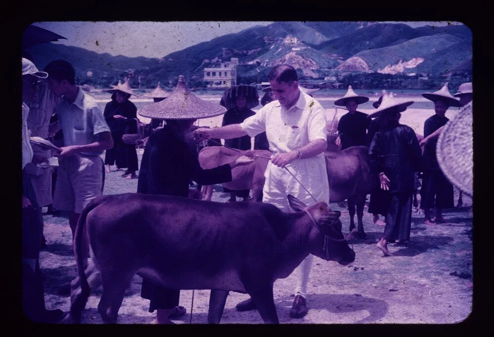
Widows being gifted cattle by Horace Kadoorie (source: HK Heritage)
After 1949, a massive influx of refugees forced Hong Kong to confront a looming hunger crisis. The colony’s survival depended on turning the rugged New Territories into productive farmland. Stepping into the gap was the Kadoorie Agricultural Aid Association (KAAA), founded in 1951 by Lawrence and Horace Kadoorie.
The brothers designed a model for self-reliance, terracing steep hillsides across Tai Mo Shan and equipping refugees with livestock, tools, and training. KAAA distributed tens of thousands of animals, supplied agricultural infrastructure, and donated enough cement to build over 300 kilometers of rural roads, dams, and irrigation channels. By the 1970s, these farms supplied over half of Hong Kong’s fresh greens.
Today, the Kadoorie name is associated with luxury addresses like Kadoorie Avenue. However, the true monument to this history lives in the forgotten corners of the New Territories: the abandoned pigsties, concrete footbridges, and water embankments still stamped with the KAAA insignia, marking where displaced people engineered their own survival.
Conclusion
From the seasonal emptiness of rural markets to the hemp-and-oil trades of Yau Ma Tei, the city’s map was forged by a visceral battle for sustenance. Every major cartographic shift records this spatial friction. When the pungent reality of the salted fish trade threatened colonial sanitation, the state cloaked the odor behind the floral poetry of Mui Fong Street. When duplicated "Market Streets" jammed the bureaucratic gears of empire, officials wiped them away in favor of mainland cities. This history reveals an urban landscape built on sheer improvisation, engineered by wartime tycoons, market gardeners, and hill-terracing refugees. Whether buried under reclamation or preserved in asphalt, the baseline remains unchanged: Hong Kong's geography is dictated by its appetite.
In the Next Installment...
Securing raw food was only half the battle. As Hong Kong shifted from outpost to colony, it confronted an even more volatile challenge: water, ice, and every liquid the city depended on.